Since the dawn of time, mankind has been blessed and burdened with an insatiable desire to explore. But, in the cases of Magellan, Columbus, or Lewis and Clark, history shows that even the bravest of explorers relied on navigation tools to help guide them in the right direction.
Humanity has tried to map the known area around them for thousands of years. Today’s topographical maps are more developed, and can give advanced readings of one’s surrounding area. The compass, a little more modern than the first maps, has been in use for over 1600 years, and is a time-tested model for knowing one’s place within the world. And with the recent rise of technology, GPS (Global Positioning System) models have now taken the personal navigation market by storm.
What Device Should I Choose?
So when choosing a navigation tool for your adventures, whether hiking, backpacking, or hunting, which device should you bring?
The GPS map has the most current technology, fits easily in a pocket or backpack, and has so many additional features that you’ll want to do away with your old maps and compasses for good. So GPS devices should be the obvious choice……right?
Are compasses and maps outdated? Or is there more to them than we realize?
In this article, we’ll break down the functions of each unit, and which one you should use for the outdoor activities you love.
Map
 As stated earlier, maps have been constructed and used for navigation for thousands of years. They give great 2-dimensional readings of a certain area, give the scale of that area, and help point out specific landmarks that adventurers can use to guide them to their destination.
For backpacking, hunting, or wilderness travel, they are not only essential to bring along, but should be studied very carefully before and during the trip, especially if it is your first time in the area. Tom Harrison Maps or National Geographic Maps are amazing high-detail maps that any outdoorsman should bring – all for under $10!
And if you’re worried about venturing outside of your map’s area, don’t! While maps only cover a specific area (usually a large national park), popular longer through-trails, such as the Pacific Crest Trail, John Muir Trail or Appalachian Trail have their own designated maps. If you think you may enter a different map’s area, do the research beforehand and decide if you need one or two maps.
For those still unsure about the benefits of having a map, we’ve compiled a list for you:
- Maps are print in nature – which means NO BATTERIES and NO INTERNAL FAILURE.
- Speaking of item failure, maps are virtually immune to large falls.
- Maps can be as overarching or as detailed as you want – we prefer to use one for far-away general views, and one to map out the specific trails we will use.
- Maps are much cheaper than GPS devices.
- Most maps on today’s market are waterproof – just let them dry out if they get wet.
- You can easily track your position and landmarks on the paper with a pen or pencil.
- Maps are physically larger than GPS devices – giant foldable papers compared to a small screen.
Maps are pretty great in their own right; however, there are a couple disadvantages to using maps over GPS.
- Maps only cover a certain area – if you happen to venture outside that area, there’s nothing that map can help you with. We recommend researching where you’ll be ahead of time.
- Maps take a bit of savvy to use (but we think it’s worth it in the end).
- Maps are not as quick and convenient as GPS – they require a bit of time to examine in detail.
Overall, we think the advantages of having a map definitely outweighs its disadvantages. Maps are more reliable for long trips or for longer distances, and we recommend bringing a map along each outdoor excursion you go on.
Compass
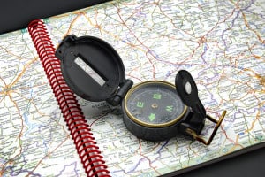
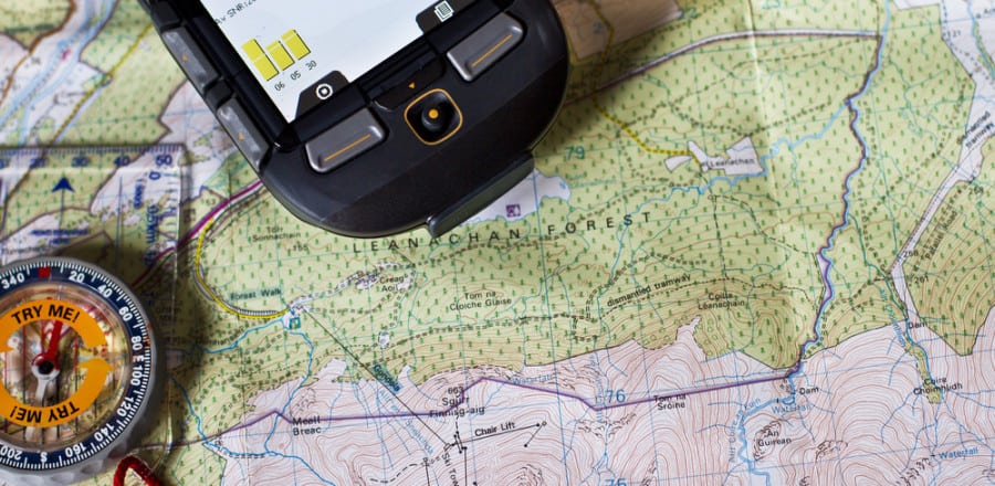
 For all the benefits that maps give, simply reading a map won’t do you much good – unless you have a solid compass to pair with it.
Compasses give life to a map by pointing north, helping you not only find out where your immediate location is, but how to get to your destination. When looking for a compass, it is important to determine whether the compass is pointing to magnetic north or true north. If the compass is pointing to true north, reading a map will be easy. However, if your compass points to magnetic north, there’s a bit of work you’ll need to do, called declination, in order to figure out the real direction of your compass. Because magnetized compasses will pick up on smaller magnetic pulls, you can use your compass to measure the declination – the error between magnetic north and true north – to find the direction you actually want to be going in.
The best wilderness compasses have features that pair well with maps, such as silicon feet to stick to maps well, or luminous markings to read the map well at night. Compasses also have different features, such as a measurement markings for reading distance on a map. Some may also feature clinometers, which measure angles of inclination.
There are tons of different compasses on the market, and if you’re interested in reading more about compasses in depth, we’ve done a full-length compass review here. But for now, we’ve compiled a list of advantages to bringing a compass next time you go on an adventure.
- A compass always points to true north – if you get lost, you can always follow the direction you came from.
- Compasses can pair with maps very well – they help magnify maps, mark distances between points, and show the direction you should generally head in.
- Compasses are lightweight and inexpensive – perfect for backpacking or lightweight hunting trips!
As with any traditional tool that technology has surpassed, the compass has a few drawbacks to it as well:
- You need a map to work with the compass – knowing your north will only get you so far if you don’t know the path the trail is supposed to lead you.
- Compasses are difficult to set and analyze for those new to them.
- If a magnetized compass, it will point toward magnetic north – not true north.
GPS
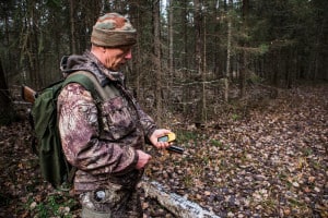
 Global Positioning System (GPS) devices are a real game changer for personal navigation, especially in the outdoor industry. The best GPS units, such as the Garmin Oregon 600 or Garmin Montana 680, are amazing multi-purpose devices aimed at long-term outdoor use. They come equipped with a built-in electronic compass, cameras, wireless communication, color touch screens, and other great features. However, for those looking to take longer trips, GPS devices will eventually run out of battery and become nonfunctional.
GPS units brought maps into the 21st century, appealing to those more familiar with smartphones and ease of use. They are great to have on any hiking or hunting trip – but are they really necessary? We’ve put together a list of the benefits of taking a GPS device along your trip.
- All-in-one: comes with built-in compass, tracking system, and high-tech 2-D (and sometimes 3-D) interactive maps.
- Usually comes with additional features, such as weather tracking, altimeter, barometer, and step tracking.
- Covers all area, no required buying of specific maps or areas
- If traveling alone, having a GPS with O.S. or position tracking features is a great idea.
- Sets up waypoints, little breadcrumbs that allow you to retrace your steps.
- Convenient touch screen or smartphone-style interaction.
- Pairs well with social lifestyle – share maps and trails with friends.
To the great advantages that GPS technology gives those looking to explore the outdoors, it also has quite a few disadvantages:
- May not work in heavy storms, etc., that disrupt the signal.
- If the satellite signal is weak, it could update your position very infrequently or give you a very inaccurate position altogether.
- Good GPS units are very expensive compared to buying maps.
- Most decent GPS units come with 15-25 hours of battery life – for longer trips, they may be rendered ineffective.
- GPS units will come with additional service fees – maps and compasses win this one!
- Electronic item; not quite as durable as traditional maps in storms/water.
- Another item to carry in your pockets in addition to your phone.
The Bottom Line
So which navigation device is right for you?
Maps and compasses provide great detail and present a large, easy-to-see map. GPS devices are great for those looking for a convenient smartphone-like device to guide them outdoors.
Our personal recommendation is that any avid outdoorsman should first know how to use a map and compass, and rely on those for navigation to keep the trip running smooth. We believe that GPS devices are not necessary, as they add unnecessary weight to a pack, will eventually run out of battery, and may lose signal under thick treeline or in heavy storms. However, if you think the money to put toward a GPS device is worth it, we believe that a GPS device is a good backup to having a map and compass.
If you are unsure how to use a map and compass together, there are many instructional videos online, and if you live within the United States, companies like REI offer classes for learning hard skills like map and compass use.
Next time you go on a giant backpacking trip, or go hunting with your friends, it’s pivotal that you bring a great navigation device to keep you on track – and hopefully keep you coming back for more adventures!

John Cliff says
Call me old fashioned but I would prefer to rely on a map and a compass. I am now 71 and learned to use a map at 9 years of age. By the time I was 12 I was teaching map reading to fellow Army Cadets. I then went into the Army as a “Boy Soldier” at 15 years of age and advanced My Map reading and compass work. For “Adventure Training” we were given a route in the class room and had to work out a route card, with compass bearings to follow for the journey on foot. Taking into account going up and over mountains.
As a Junior Sergeant I was on a “Army Outward Bound Course”, just down the road from my unit I was asked by one of the staff instructors to give a grid reference of a prominent white cottage up on the side of a hill. I answered straight back with the answer and was going to say who owned the cottage and when it was built Before I could, the instructor burst out with “You did not look at the map”. I then explained that the cottage is on the hill overlooking the rear of my barrack room at Tonfanua Camp, and it is one of my favourite questions when I am taking a class of junior lads on map reading. Many Years later I was working with the “Royal Artillery” as the CO’s Radio Op. and working on” DFSOS Fire Plans”. We used 8 figure grid references for those. (10 meter square accuracy) On target. My leaving present from 32nd Hvy Regt. R.A. was to act as the “Fire Control Op, in-front of High -Ranking NATO officers on a “Fire Power” demo of a Heavy Brigade shoot. M107’s. (24 guns, 5 Rounds -Fire-For-Effect)(120 shells) plus a couple of ranging rounds.
Harold says
Thank John, it’s a great experience for me and many outdoorsmen!